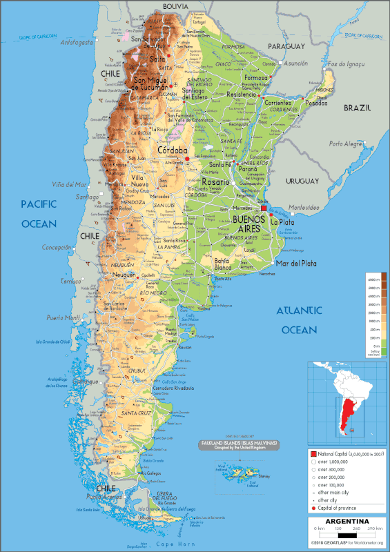
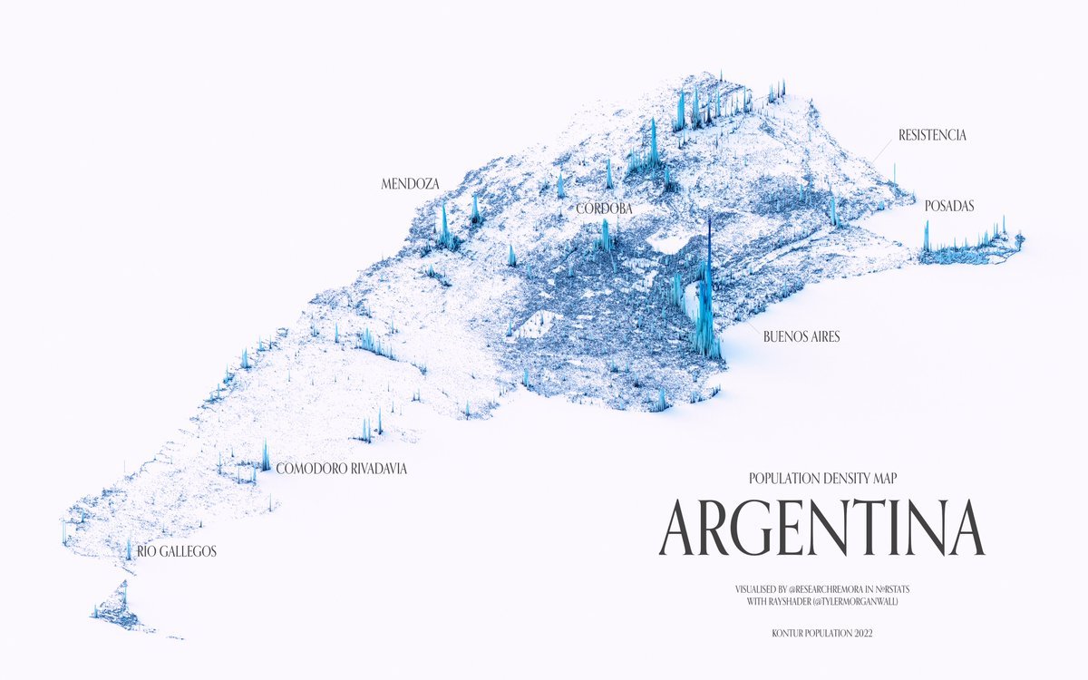
MAP OF ARGENTINA(PHYSICAL)
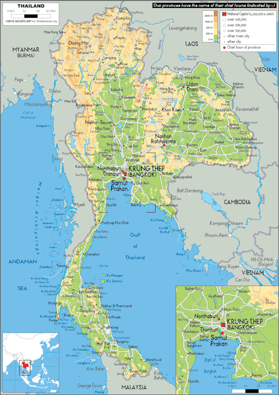
MAP OF THAILAND(PHYSICAL)
POLITICAL MAP OF THAILAND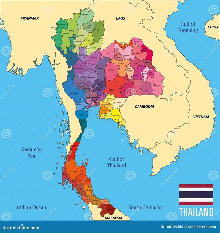
ISOLINE MAP OF THAILAND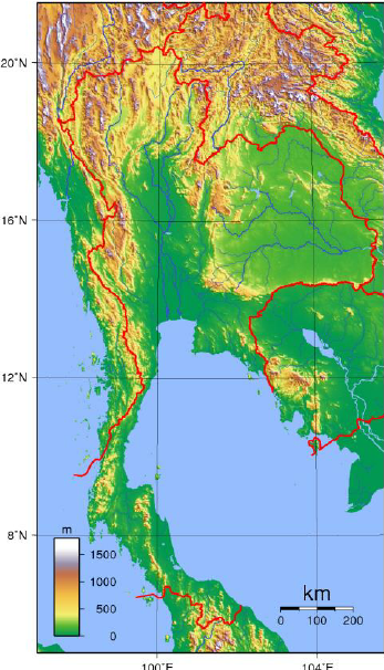
|
|
POLITICAL MAP OF ARGENTINA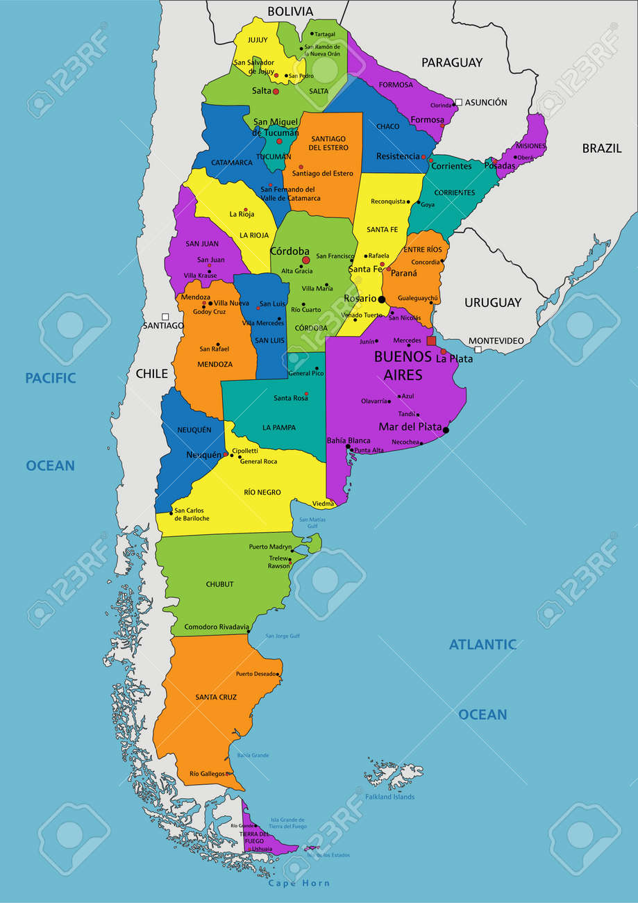

|
4 level analysis

POLITICAL MAP OF THAILAND
ISOLINE MAP OF THAILAND
|
|
POLITICAL MAP OF ARGENTINA
|
